Back in 2013, Jamie Hobbs was kind enough to show Ron and I The Devil’s Path out in New York’s Catskills Mountains. Repeatedly ranked as one of the hardest/most dangerous trails on the planet, Devil’s packs somewhere around +/-19,000′ of climb/descent across 6 mountains (and 8 peaks) in its 25 miles of highly technical trail. It’s rated as a highly strenuous, three-day hike. In 2014 I was able to run the whole thing (along with my friends Ron and Ryan) in 12 hours (for comparison, the fastest known time is just under the 5 hour mark). In addition lots of climb and descent (there are no ridges in between the peaks), the trail is highly technical, riddled with roots, rocks, and cliff bands. If you’ve heard absurd descriptions of this trail? Don’t write it off as hyperbole. It’s almost impossible to overstate how challenging this trail can be.
I’ve now been out on the Devil’s Path (and been mountain racing in the Catskills) a few times over the last few years, and this weekend had the honor of introducing some fellow Rochester trail runners to a trail and region that I’ve come to love. Sean, Mike, and Colin had expressed interest previously in checking out these Catskill trails (and the various races held there), so doing a quick day trip out to run the tough Eastern half of the trail seemed like “a good idea.” And it definitely was!
We left town early (3am) on Saturday, dropping the car off at Notch Lake/Devil’s Tombstone on Route 214, where a prearranged taxi (Smiley’s in Tannersville) shuttled us over to the trailhead on Prediger Rd. We got started before 8am and covered the 12 miles back to Route 214 in a little over 5 hours, running over Indian Head, Twin (both peaks), Sugarloaf, and Plateau Mountains in the process. The weather was beautiful! 25 degrees to start, but bright and sunny with great views of the foliage and surrounding peaks. I’m pretty sure that fall foliage is the best time of the year to be in the Catskills. It’s truly picturesque. Clouds were blowing in by the time we finished (we could see snow falling over the peaks on the horizon), but we had an amazing day on great trails (followed by incredible food (and beer) at Phoenicia Diner), before making the drive back home.
I’ve been very fortunate to get out and run mountains as often as I do, and it was a true privilege to introduce others to these trails. Strava GPS run info appears above, and photo gallery appears below (captioned as accurately as I can recall). Enjoy!
 Trailhead, Prediger Road. (Image: Bailey)
 Beginning of the day on the approach to Indian Head.
 One of the early scrambles on the climb up Indian Head. (Image: Storie)
 Root ladder climbs up Indian Head. (Image: Bailey)
 Fading fall foliage was still breathtaking from up on Indian Head.
 Descent off Indian Head Mountain into Jimmy Dolan Notch. (Image: Bailey)
 Stunning views from Twin Mountain (South Summit).
 Twin Mountain selfie (South Summit).
 Descent off Twin Mountain.
 Descent off Twin Mountain.
 Descent off Twin Mountain into Pecoy Notch. (Image: Mertsock)
 Climb up Sugarloaf Mountain.
 Climb up Sugarloaf Mountain.
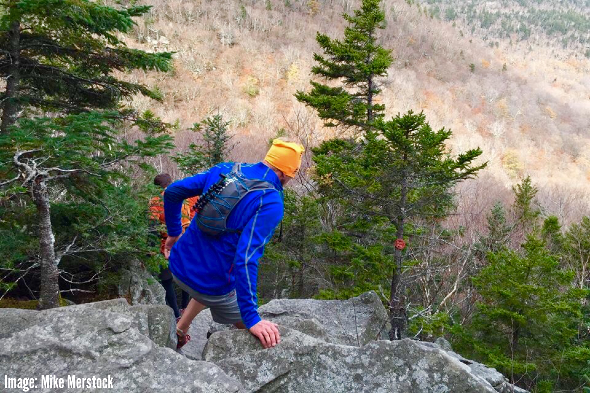
 Descent off Sugarloaf Mountain. (Image: Mertsock)
 Descent off Sugarloaf Mountain. (Image: Bailey)
 Descent off Sugarloaf Mountain into Mink Hollow.
 Climb up Plateau Mountain. Nearing the top as clouds rolled in from the Hudson Valley. (Image: Storie)
 Climb up Plateau Mountain. Nearing the top as clouds rolled in from the Hudson Valley.
 Beautiful singletrack along the top of Plateau Mountain. (Image: Mertsock)
 View from Sam’s Point, top of Plateau Mountain before the descent.
 View from Sam’s Point, top of Plateau Mountain before the descent.
 Group photo at Sam’s Point, top of Plateau Mountain. (Image: Bailey)
 The looooong descent off Plateau Mountain.
 Bottom of Plateau Mountain before coming out on Route 214.
 The incomparable Phoenicia Diner. Speaks for itself.
All images Copyright Ben Murphy unless otherwise noted, 2015. All Rights Reserved. May not be used without explicit, written permission.
[…] Image: Catskill Trails, October […]